Las Vegas McCarran International Airport (LAS)
Driving Directions / Travel by Car
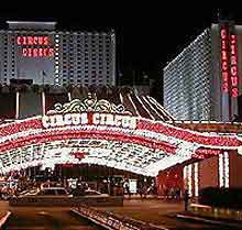
(Las Vegas, Nevada - NV, USA)
A fairly isolated and sprawling city surrounded by the desert, Las Vegas is home to the McCarran International Airport (LAS), the region's most important transport hub. Most people choose to fly into Las Vegas Airport and will find the famous Strip just minutes away and an easy drive.
Roads surrounding the McCarran Airport complex include the I-15 interstate and South Las Vegas Boulevard ('The Strip') on the western side, and Paradise Road to the east. Also nearby, the US-593 highway (Tropicana Avenue) skirts the northern edge, while the US-562 highway (East Sunset Road) runs to the south, between the Callaway Golf Center and Sunset Park.
Directions to Las Vegas McCarran International Airport (LAS) from the city center:
- The airport is situated to the south of the Las Vegas Strip
- Just 2 miles / 3 km from downtown Las Vegas, the airport is well signposted along the I-15 interstate, which leads to the heart of the city
Directions to Las Vegas McCarran International Airport (LAS) from Russell Road to Airport Terminals
Travel along Russell Road in a westerly direction
Continue under the bridge
Turn right and follow signs for the airport terminals
Both of the terminal buildings are individually sign posted
Directions to Las Vegas McCarran International Airport (LAS) from Highway I-215 to the Departure Curb
- Travel along the I-215 interstate
- Continue under the tunnel in a northerly direction
- Keep to the right and follow the airport signs for departing flights
- Keep to the left until the Las Vegas Airport Departure Curb is visible
Directions to Las Vegas McCarran International Airport (LAS) from Paradise Road to Short-Term Car Parking
Travel along Paradise Road in a southerly direction
Red triangles on the road indicate the route towards the main short-term car parking area
Follow the sign posts
Las Vegas McCarran International Airport (LAS): Virtual Google Maps
